Software used
Content last updated: 26th May 2022 19:30 (UTC)This site mainly uses Cartes du Ciel Skychart to see the night sky. The software has been used to produce all the night sky images on this site. The time and date has been preserved on every image so they can be verified.
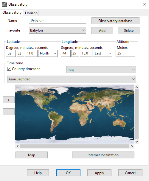
The following position was used for Babylon:
32° 32' 11.0" North & 44° 25' 15.0" East.
Altitude: 25 metres
See image below
Alcyone Ephemeris
More articles